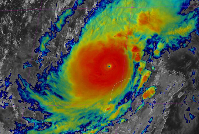
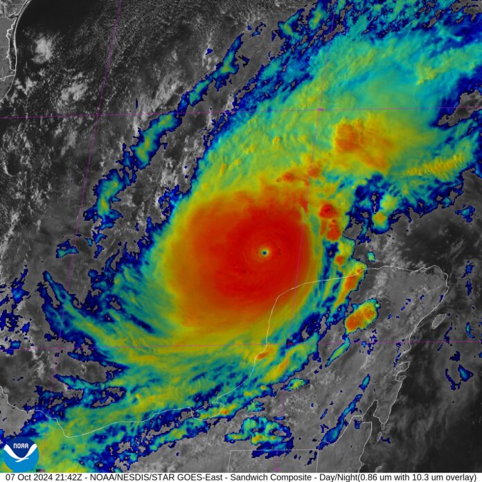

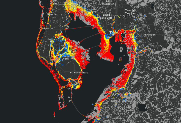
The storm is expected to make landfall as a high-end Category 3 or 4 storm on Wednesday evening. It will bring with it winds of 120-140 m.p.h. and heavy rainfall. The biggest story, however, will likely be the surge. As the storm grows in size it will gather a ton of water. A landfall angle of nearly straight on with the coast will lead to extremely high surge, particularly in any bays or inlets. If the storm makes landfall in or just north of Tampa Bay, a catastrophic, never seen surge is likely in the bay area. The latest from the National Hurricane Center calls for a 10-15ft surge along a large portion of the coast from the Anclote River to Englewood.
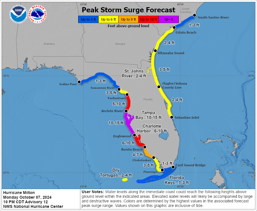
This much surge will inundate a large area inland. The only benefit may be that the current landfall time would fall around low tide which could make a foot or two difference. This zoomed in map shows how far inland the surge could reach in the Tampa Bay area. A stronger storm making landfall just north could cause this to be even worse. If you have any friends or family in this area please urge them to get out as soon as possible.
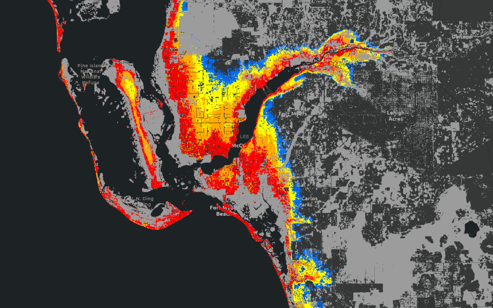
Sarasota down to Fort Myers will also be incredibly hard hit by the surge. The image below shows a zoomed in look at the Fort Myers area. A surge of this level would cause incredible devastation well in from the coast.
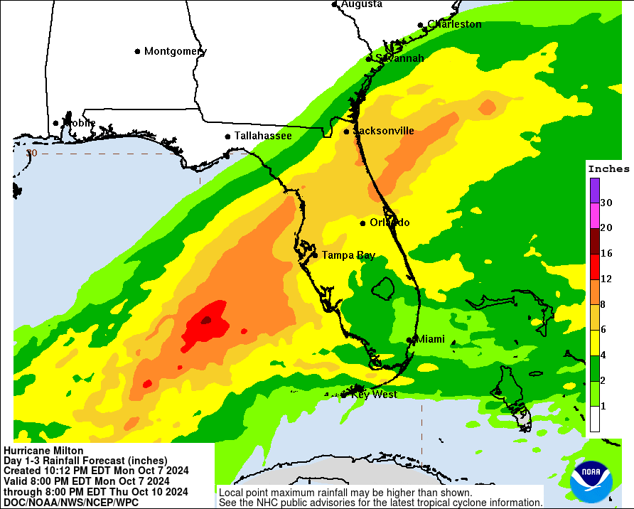
In addition, heavy rain is currently falling across much of the state which will worsen the flooding potential once Milton arrives. Currently a widespread 6-12″ of rain is expected from roughly Tampa to Orlando and points north. A moderate risk of flash flooding is currently in effect
We’ll continue to provide updates on this storm to keep you informed. Be sure to urge any friends and family to get out while they can.
Back link: https://nowhabersham.com/milton/
Post Author: Now Habersham